Explore the Future of Plant Healthcare with GeoPonos AI-Plant-Disease-Detector
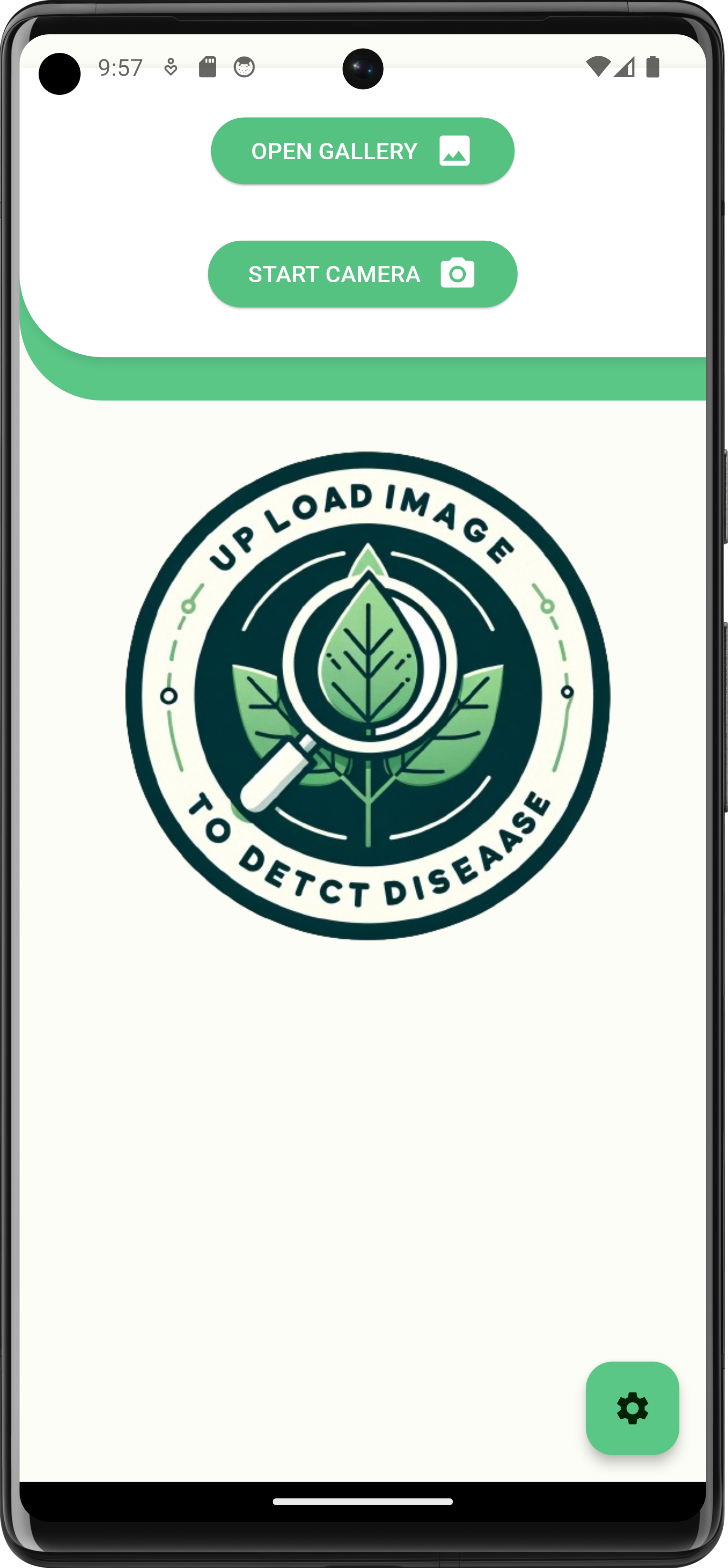
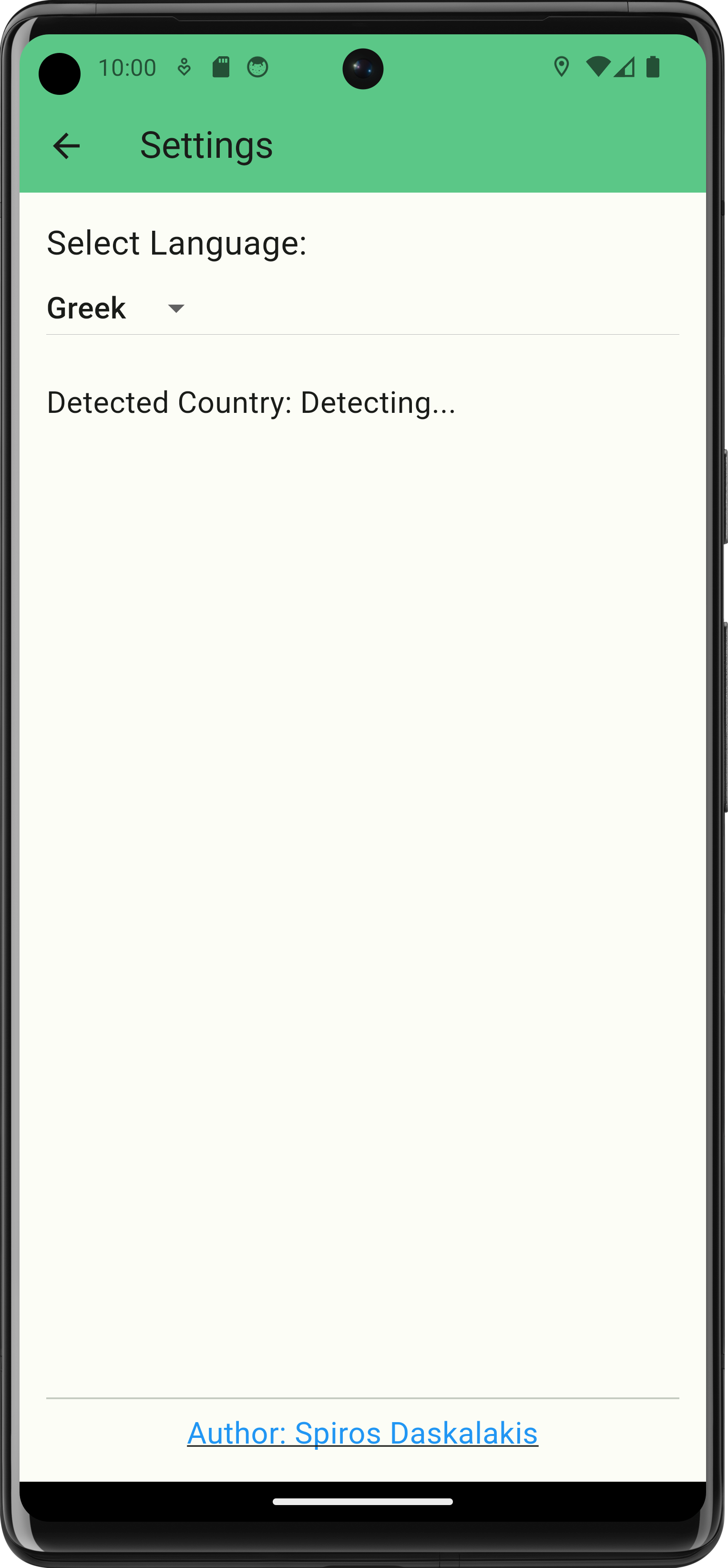
In the pursuit of advancing agricultural technology, we proudly introduce the GeoPonos AI-Plant-Disease-Detector, a groundbreaking application designed to revolutionize plant care and disease management. Powered by the state-of-the-art GPT-4 Vision API from OpenAI, our app is an invaluable tool for farmers, gardeners, and plant enthusiasts alike. With its cutting-edge AI capabilities, GeoPonos AI-Plant-Disease-Detector offers precise and rapid identification of a wide range of plant diseases, simply through the analysis of a photo. This intuitive and user-friendly app not only detects plant health issues but also provides essential precautionary steps for disease management, catering to both professional and amateur plant caretakers. Our commitment to fostering a sustainable and healthy agricultural future is at the heart of GeoPonos. Embrace the ease of digital technology in plant healthcare and step into a greener future with GeoPonos AI-Plant-Disease-Detector.
Related Media:
Code:
VineSpy: Battery-Free, Low-Cost WSN for Vineyard Smart Agriculture Applications
Today, insufficient water supplies and adverse climatic conditions are critical issues that Mediterranean countries face the last years.
The challenging environmental conditions can lead to agriculture
production problems such as increment of water use and other agricultural resources like pesticides and fertilizers.
As a result, the farmers increase their operational costs in order to reduce the outcome of these changes.
In order to minimize the production risk, there is a necessity for precision agriculture techniques in production.
The producers should stop make decisions based only on their own practical experience and they should advice modern farming management concepts using digital techniques to monitor and optimise the agricultural production processes.
Mediterranean countries like Spain, France, Italy, Greece and Turkey are the main
grapes grower countries worldwide and all combined represent more than 30% of
world’s vineyard. In addition, wine grapes are the most produced variety worldwide
with 47% and it is the variety that these countries mostly produce. Even though there
the minor decrease on grapes production, international wine trade it is becoming
bigger and bigger with a constant increase the last year because of the trend in wine
consumption. According to the above there a necessity today for affordable precision
agriculture measurement systems in vine sector.
In this work is proposed the VineSpy, a wireless sensor network (WSN)
with low-cost sensor nodes affordable for most of the vine farmers. Through VineSpy
the farmers will be able to achieve a more efficient multi-microclimate monitoring and
optimize their daily tasks which lead to a better use of their water/pesticides supplies
and reduce food waste. In addition, the use of small solar panels
will provide energy autonomy and will reduce the costs compare to other
conventional systems. The users of VineSpy will be able to reduce their operational
costs, improve product’s quality and reduce the carbon footprint of their production.
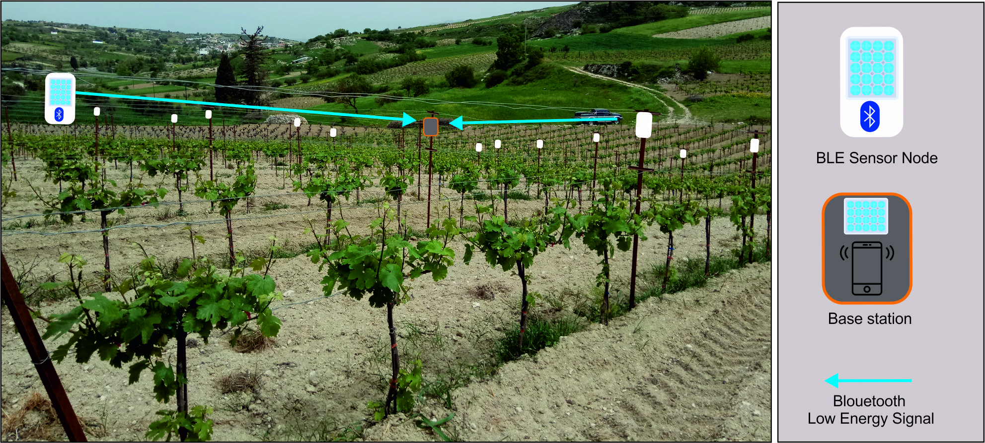
Each sensor node will have a super capacitor instead of battery thus the idea is to create a low
maintenance system. One sensor node will include environmental sensors of
humidity, temperature, atmospheric pressure and it will be able to send data to a low-cost
base station via Bluetooth Low energy (BLE) technology. The base station will
be in the middle of the vineyard field and it will consist of an cheap smartphone with BLE
connectivity. The smartphone will be inside a waterproof box and will be powered by
a solar panel. Its is the first time that will be used a cheap smartphone as base
station instead of heavy, costly solutions with complex electronics like GSM modem,
BLE receiver, computer and batteries.
In order to extend the range of the sensor node, a small efficient antenna will be designed without the need of an extra amplifier.
To reduce power consumption, the BLE device is kept in sleep mode most of the time. When an event occurs, the device wakes, takes the data from its sensors and a short message is "advertised" wirelessly to the “smartphone” base station.
Then the smartphone can upload the information to the cloud.
Related Media:
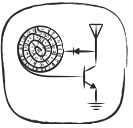
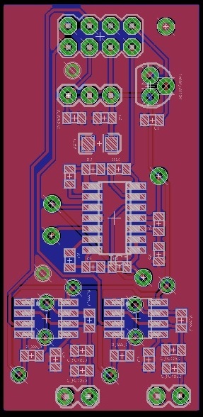
FM Ambient backscattering for Low Power, Low-Cost Communication and Sensing
Today, the Internet-of-Things-related applications require the design of low-cost and low-power wireless sensor nodes.
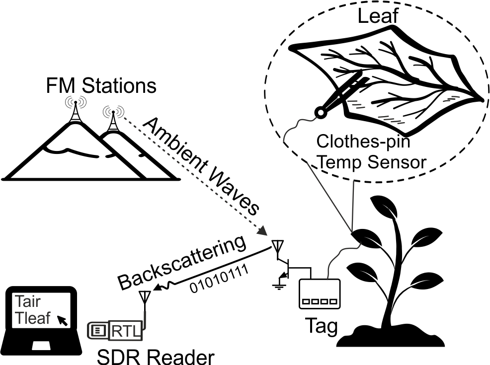
Although backscatter radio communication is a mature technology used in radio frequency identification (RFID) applications, ambient backscattering is a novel approach taking advantage of ambient signals to simplify wireless system topologies to just a sensor node and a receiver circuit eliminating the need for a dedicated carrier source.
This work introduces two novel wireless tags that utilize broadcast frequency modulated (FM) signals for backscatter communication.
The first tag uses binary modulation and the second, a high order modulation technique for the communication.
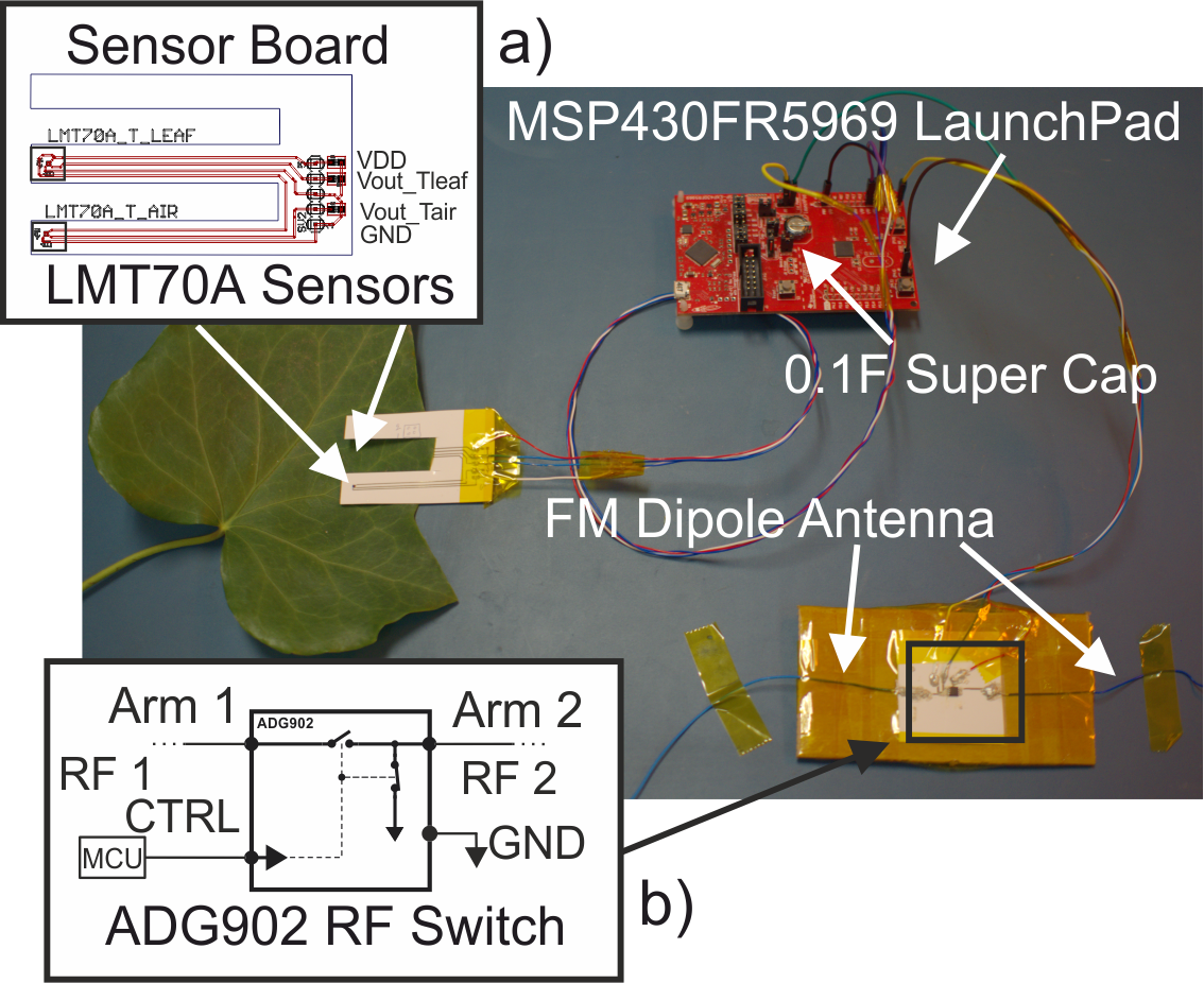
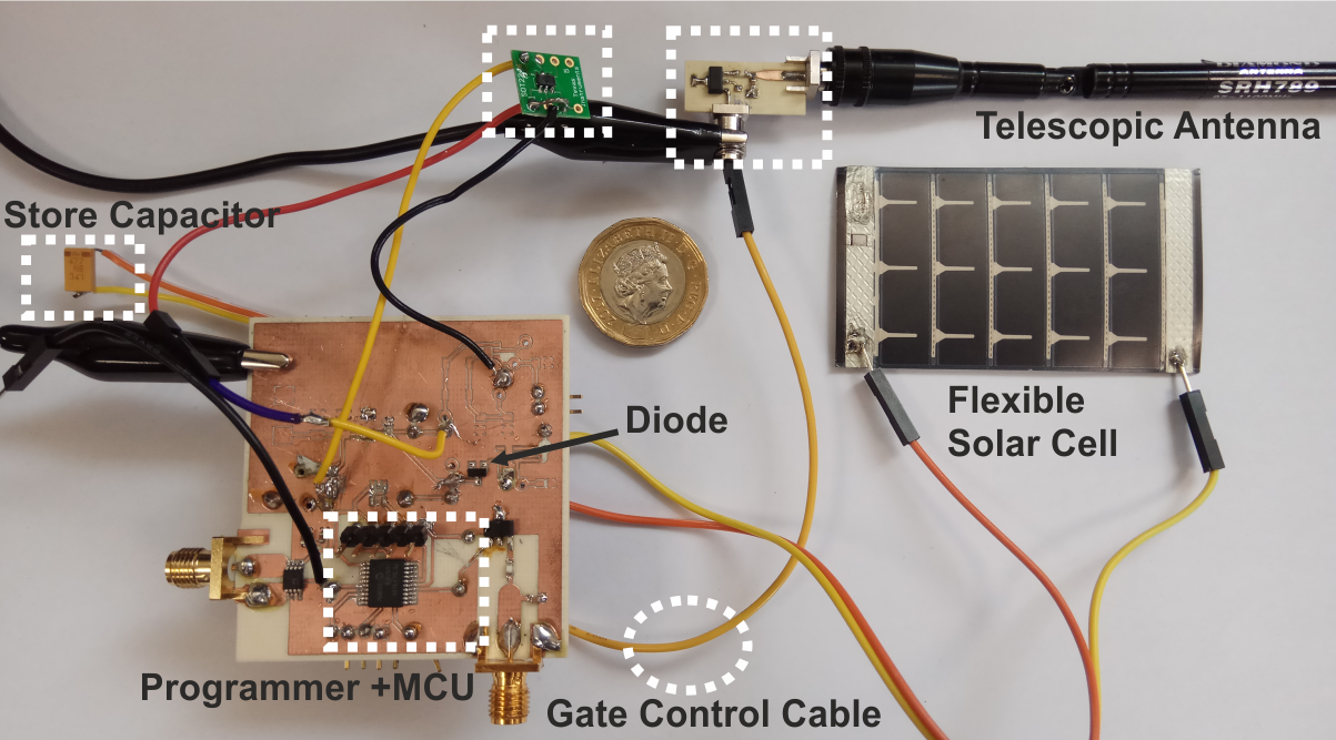
Each proof-of-concept tag consists of an ultra-low power microcontroller (MCU) and a radio frequency (RF) front-end for wireless communication.
The MCU can accumulate data from sensors through an analog-to-digital converter, while it transmits the information back to the receiver through the front-end by means of backscattering.
In the first tag, the front-end uses On-Off keying (OOK) binary modulation and FM0 encoding on ambient FM signals.
The second design utilizes the 4-pulse amplitude modulation (4-PAM) and uses a digital-to-analog converter (DAC) for the RF front-end control.
The receiver consists of a commercial low-cost software defined radio which downconverts the received signal to baseband and decodes it using a suitable signal processing algorithm.
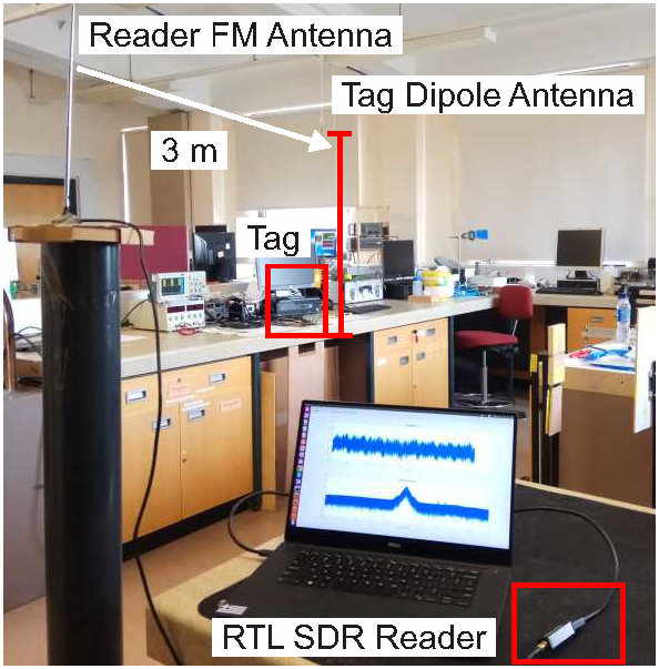
Both prototype tags were demonstrated indoors using an FM station at 34.5 Km away.
The first tag with binary modulation was tested for a 5 m tag-reader distance and it was demonstrated by backscattering information at 2.5 Kbps featuring an energy per packet of 36.9 uJ.
Using the 4-PAM, a second prototype was demonstrated over a 2 m tag-reader distance for a low bit rate of 345 bps with power consumption only 27 uW.
The value of energy spent in this modulator was 78.2 nJ/bit at 345 bps and 27.7nJ/bit at 10.2 Kbps.
Download Simulation Files.
Related Media:

![]()
Backscatter Wireless Sensor Networks for Agriculture
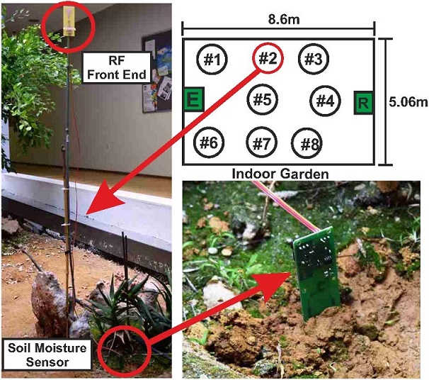
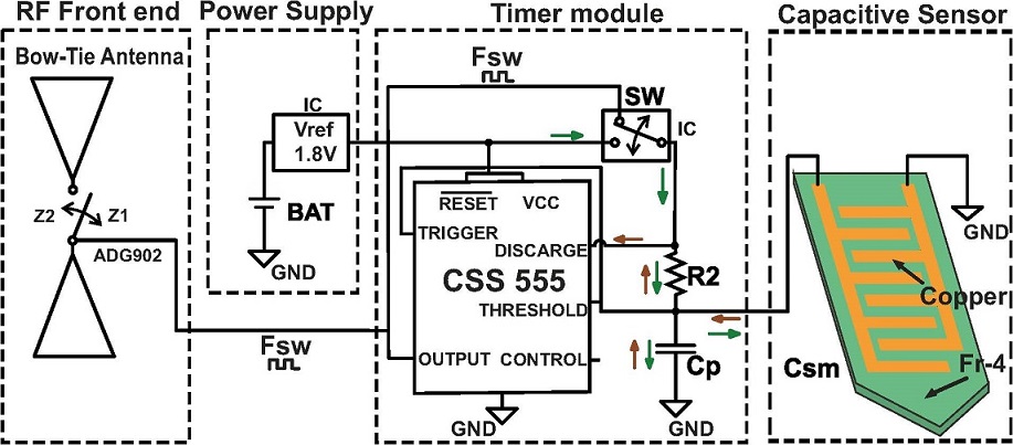
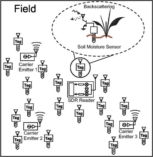
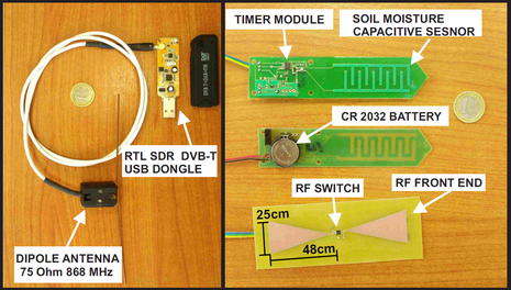
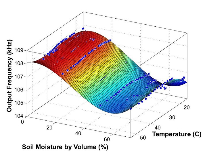
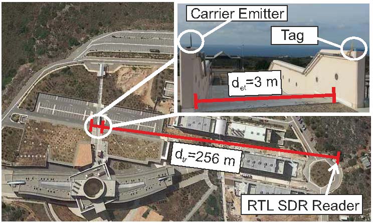
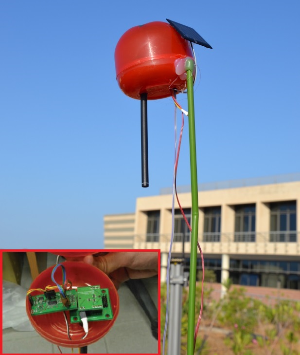
Modern agriculture applications necessitate cheap, effective, low-maintenance and low-cost wireless telemetry for various environmental parameters, such as soil moisture, air humidity and temperature in the vicinity of multiple plants within the same field. Such continuous and dense environmental monitoring is critical for optimal crop management techniques and water saving. Thus, wireless sensor network (WSN) technologies for micro-climate monitoring in extended areas, are indispensable within this topic. Conventional WSNs consist of a large number of nodes, forming a (possibly mesh architecture) network in order to transfer monitored environmental data to a base station. Each node typically employs a Marconi-type radio, controlled by a micro-controller unit (MCU) and the sensors. However, large-scale deployments of conventional WSN technology are not common, due to power consumption, cost and maintenance complexity. In order to address such constraints, scatter radio has recently started to be exploited in wireless sensing and particularly for the development of WSNs. Scatter radio communication is known from 1948 and today, is exploited in the RFID industry. Communication is implemented with an antenna, a control circuit and a radio frequency (RF) switch between them. While scatter-radio principles have been restricted to communication ranges of up to a few meters, a novel scatter radio sensor network (WSN) for soil moisture (%SM) measurements was developed. A low-cost (6 Euro per sensor), low-power (in the order of 200 uW per sensor), with high communication range (in the order of 250 meter), scatter radio sensor network was designed and implemented, for soil moisture monitoring at multiple locations. The network utilizes analog frequency modulation (FM) in a bistatic network architecture (i.e., the emitter and reader are not co-located), while the sensors operate simultaneously, using frequency division multiple access (FDMA). In contrast to prior art, this work utilizes an ultra-low cost software-defined radio reader (RTL-SDR), offers custom micro-strip capacitive sensing with simple calibration, as well as modulation pulses for each scatter radio sensor with 50% duty cycle; the latter is necessary for scalable network designs. Overall root mean squared error (RMSE) below 1% is observed, even for ranges of 250 m. This is another small (but concrete) step for the adoption of scatter radio technology as a key enabling technology for scalable, large-scale, low-power and cost environmental sensor networking. Digital scatter sensor nodes were also designed and build in-house, in Telecom Lab. The digital nodes project is leading by my classmate Konstantinos Tountas. The nodes consist of three separate circuit boards: the communication "scatter radio" board, the power-board and the sensor board. The scatter communication board consisted of a Silabs C8051F930 MCU, a RF Transistor, and a oscillating crystal, was designed and implemented by Konstantinos Tountas. My contribution was on the design and the fabrication of the voltage source selection circuit, choosing between a solar panel and a coin battery. Also i was working on sensing part, a board containing multiple sensors (plant signal, illuminance, temperature, plant electrical potential, soil moisture and air humidity) was constructed. The sensed data are encoded with a linear block code and are transmitted by means of reflection to a USRP SDR receiver. The topology of the system is the bistatic, the emitter and reader are not co-located and the tag is in the middle.
Related Media:
An online platform/application for finding local products around Greece.
Crete is an island with fertile land and temperate climate, which favors almost any kind of crops. For many years, agriculture and livestock underlies the economic life of the island and that is an incentive for producing products of excellent quality (like olive oil, excellent selections of wines, vegetables like “Stamnagathi”). Additionally having such products as raw material, people of our island created unique traditional goods (such as “Graviera” Cheese, “Kaltsouni” Pie, roasted barley bread known as “Paksimadi”). Based on our previous observations and given the fact that the last decade the number of visitors on the island has increased significantly, we set as our target to give farmers, animal breeders and traditional products producers of Crete, referring next as producers, the opportunity of direct selling of their products to the visitors, using technological solutions. The idea is to develop a web-based application for producers and a smart phone application for visitors (designed for Android/iOS based devices), which will be interconnected through a central data exchange system. In more detail, the producers using an easy to use Web-Based environment will create an account in our system. After that, they will be able to register on line their products with their prices and other necessary information like photographs of their products and a precise location of supplying (using exact coordinates). Then, the system operators will come in contact with them, in order to validate the registered data and check the prices to ensure good competition. On the other hand, visitors using a user friendly application on their smart phones, they can search for information about available local products in their close area using a predefined radius of search and with the support of their devices location services (GPS, Network Assisted Localization). The available locations of the found products will get pin-pointed on Google Maps. After that, our users will choose a desired pin and the application will present all the relevant information about the producer and his products. As final step, if a user wants to buy a product, he will only have to declare interest through his smartphone in order to inform the producer. The development and implementation of the proposed system will be very useful, especially for the producers but also for the visitors of the island as well as for the Greek state. The producers will have the opportunity to sell their products as retailers at very affordable prices. Additionally, visitors will have the ability to buy traditional and quality products at lower prices than the market average and finally the Greek State will earn positive reputation from the promotion of Greek products inside and outside the Hellenic borders.
Related Media:
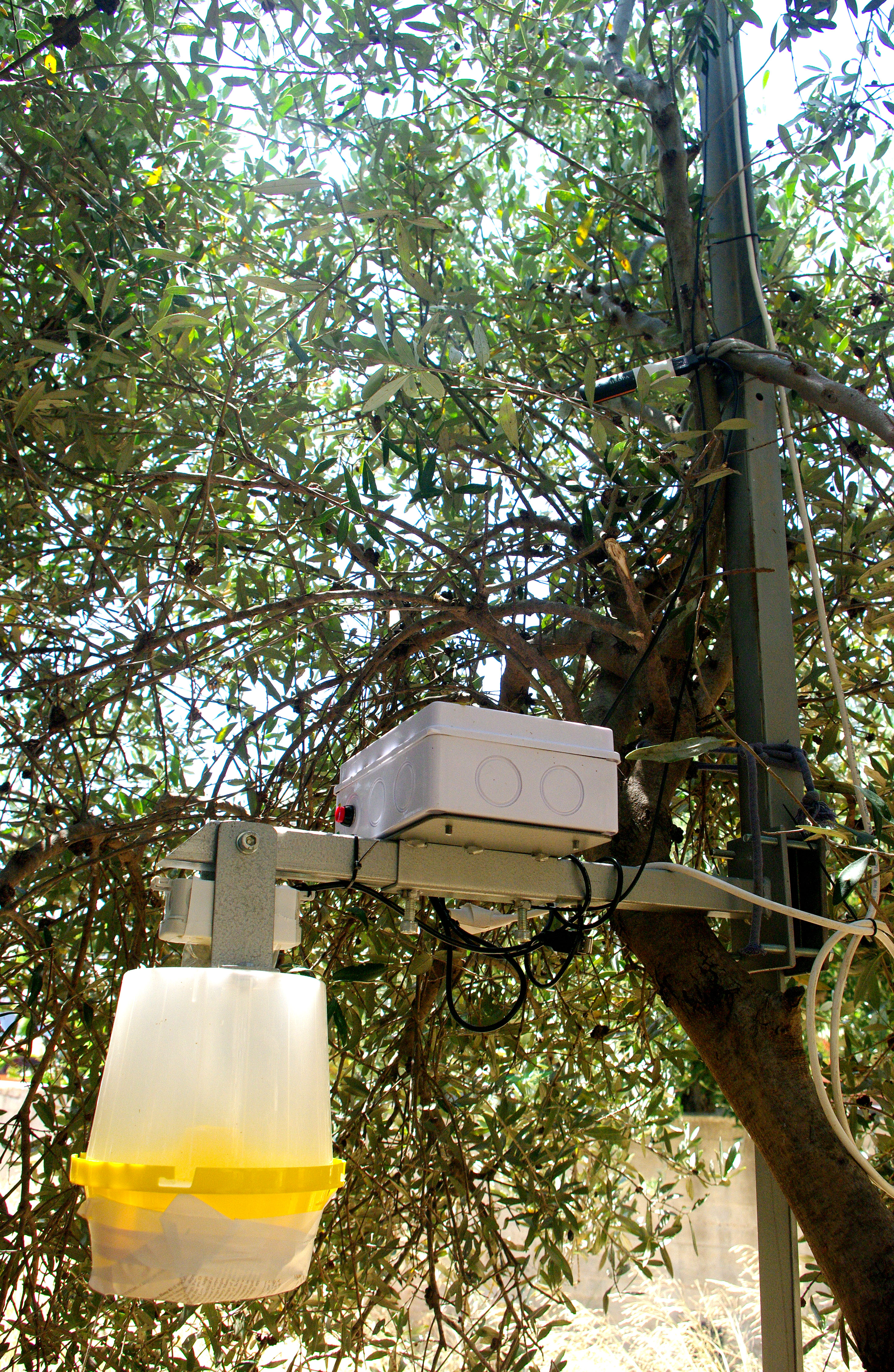
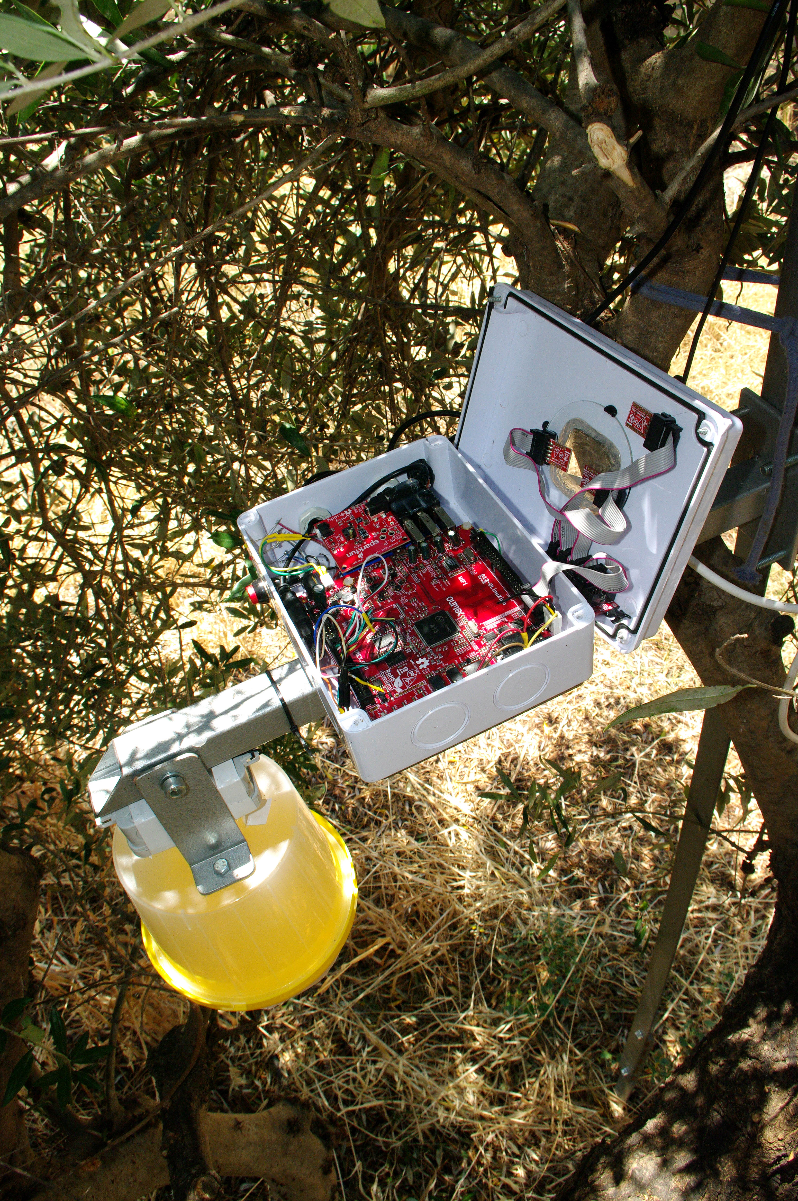
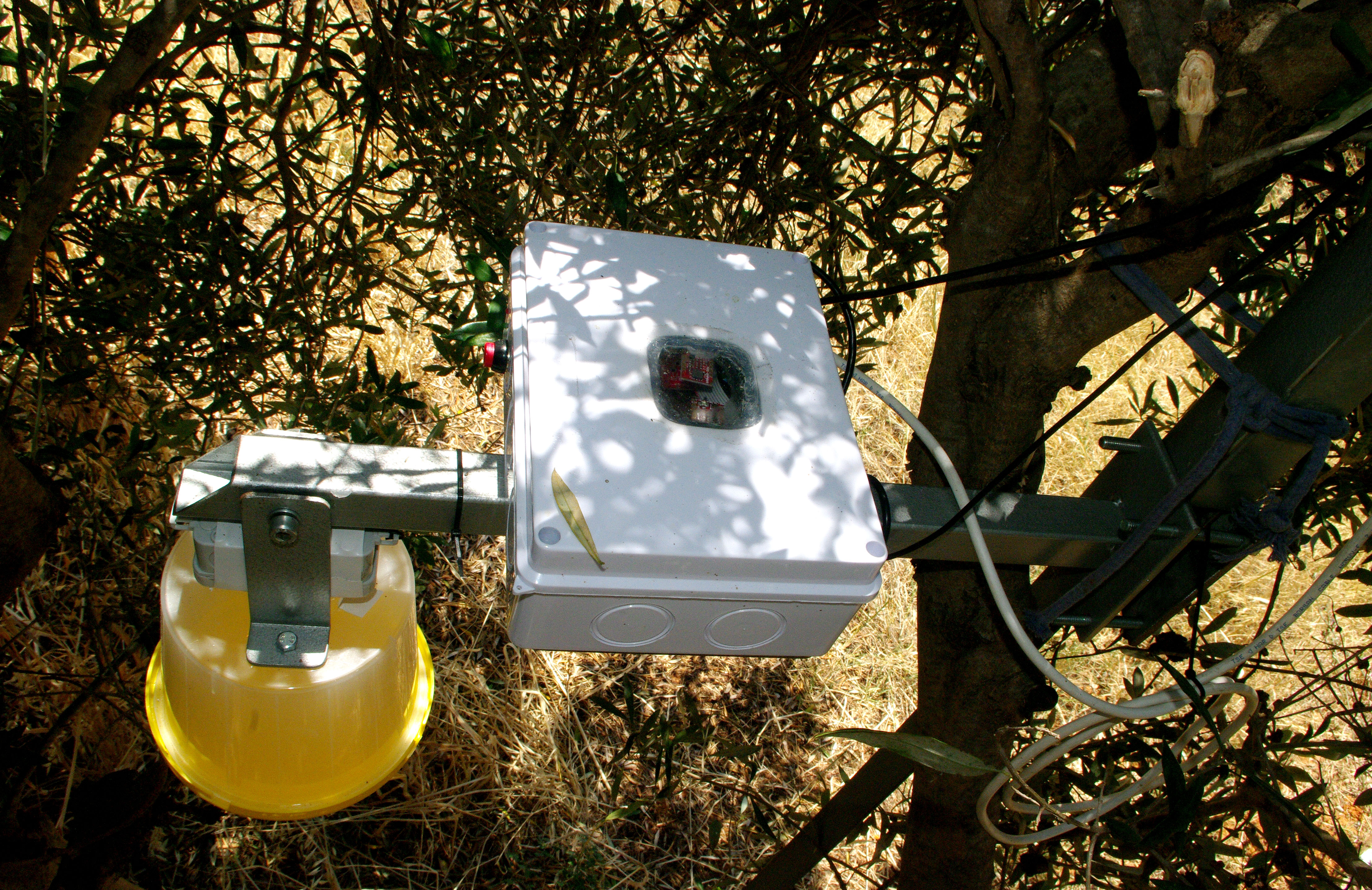
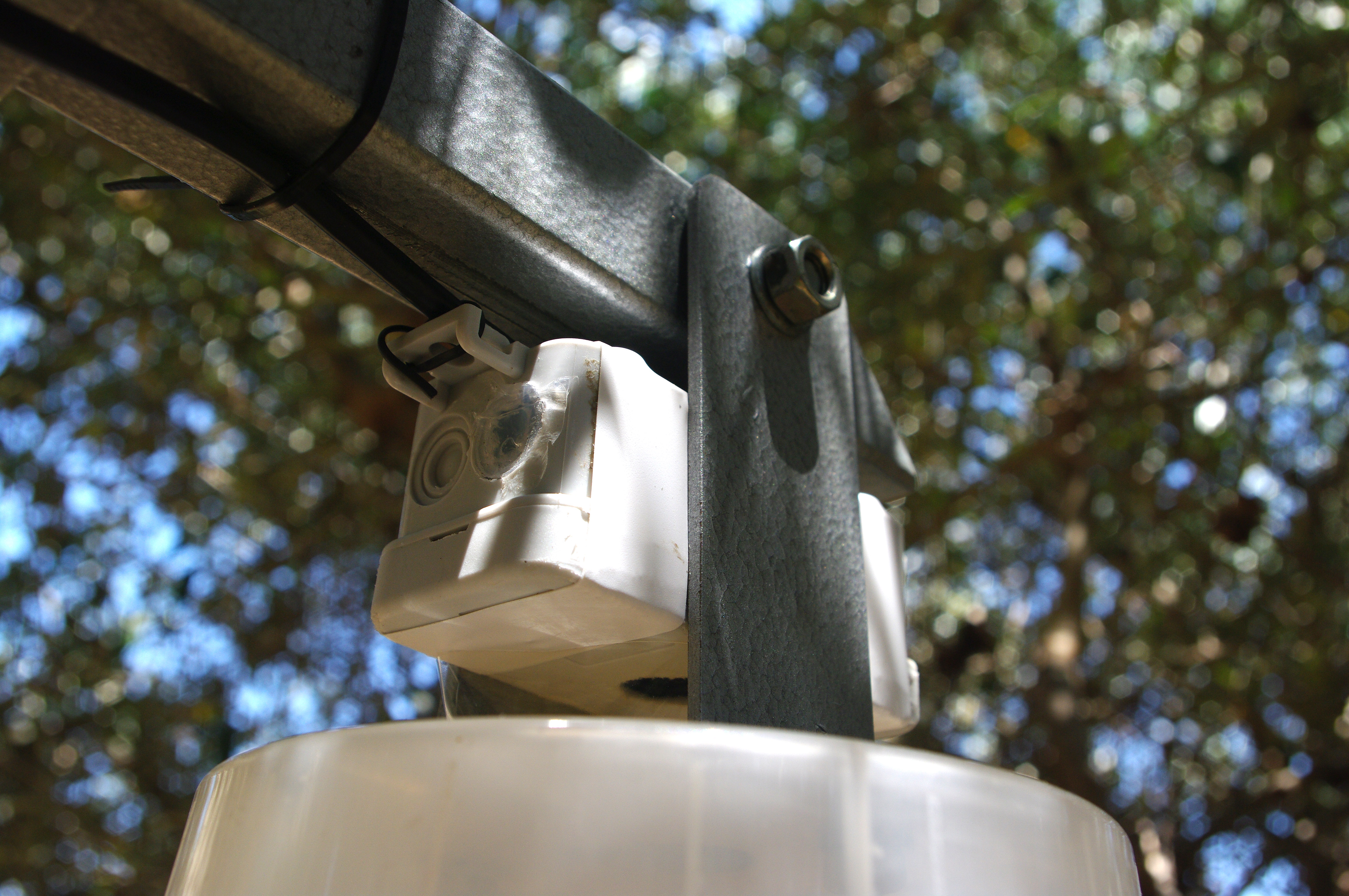
Automated Detection and Monitoring of the Olive Fly Population.
Olive oil is very healthy fat obtained from the olive, a traditional tree crop of the Mediterranean Basin. In my island Crete, the cultivation of the olive tree is deeply rooted in the tradition of the island. The trees are perfectly adapted in the climate and soils of the island and this is the secret of producing an excellent oil. Nowadays, the main threat for olives is olive fruit fly, a species of fruit fly which feeds inside the fruit, destroying the pulp. The olive fly problem is treated by detection, monitoring and management. When it comes to detect and monitoring the olive fly, being vigilant, diligent and systematic is critical as fly population can multiply rapidly. In Crete, the Greek government has appointed agriculturists to monitor populations in the spring with McPhail traps and when the traps indicate that population is increasing in early summer, agriculturists give instruction to workshops to apply bait sprays. The traps are placed in different places throughout the region of Crete thus the first application happens a week or two before pit hardening and it re-applies every 5 to 6 weeks during summer. Our idea is to develop an Agriculture wireless sensor board (single node) in order to automate the detection/monitoring procedure. Having this node and a pc/smart-phone application, agriculturists or producers can monitor olive fly populations plus different environmental parameters from their houses without visiting the olive fields. The system will be useful for preventing possible plagues with timely sprays. The sensor nodes will be installed throughout the region of Crete along with McPhail traps which are already placed and will be created a large Wireless Sensor Network. Each node will consist of a McPhail trap, a camera and a printed circuit board. Camera will receive a picture inside the trap and through image processing will estimate the number of dead olive flies. In addition, there will be sensors able to measure ambient temperature/humidity, atmospheric pressure and solar radiation. Each node will integrate a GPS that delivers accurate position of it and it will be sleeping most of the time in order to save energy. After some hours it will wake up, it will collect data from the sensors, will implement the wireless communication via GSM/3G technology, will send the collected information to a base station and will go again to sleep mode. Each node can be powered by rechargeable lithium batteries and a solar panel, making the system completely autonomous. Using Google Maps application and an Internet connection, the user will be able to watch the node position and the collected real-time data from any place in the world. Purpose of this project is to anticipate olive threats, to minimize time consumption and money, as well as maximize agriculture results. Finally the system may be useful for irrigation system manage as well as for agriculturists in research, i.e. to create statistical prediction models.
Related Media: